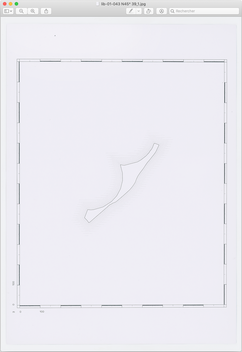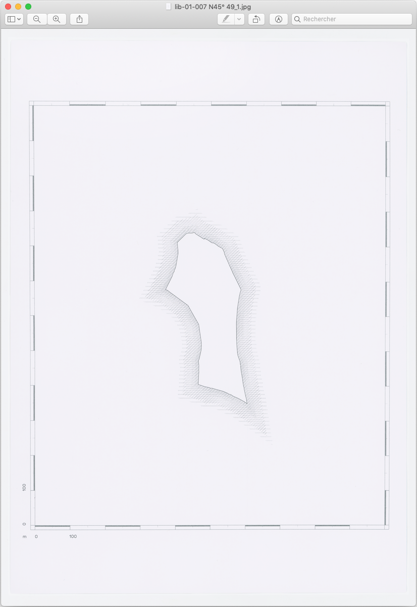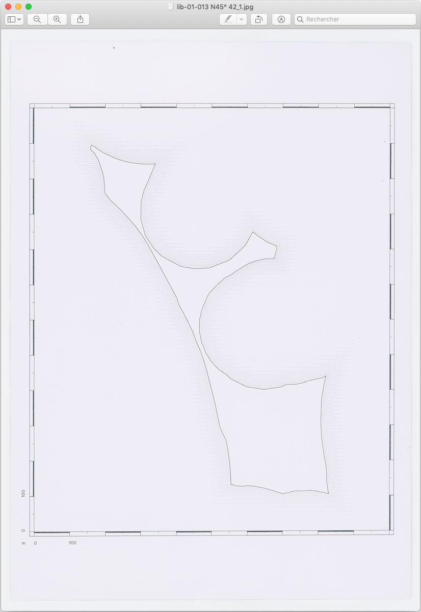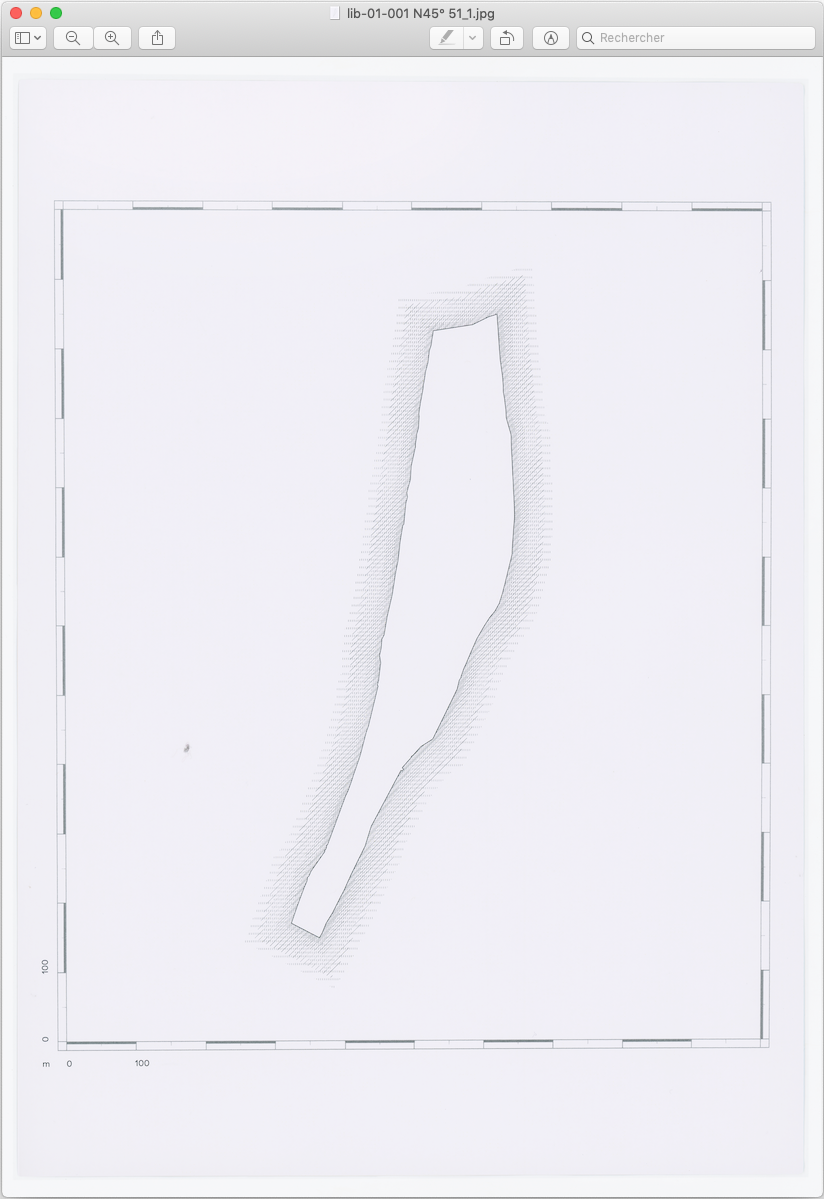
With the coverage of our planet by Google Street View and comparable services, it is now possible to walk through any corner of the world through our smartphone. Nevertheless, there are some white spots in the cartography of the networks, White Islands, which escape the datascapes. These have a more and more reduced and sometimes even movable place in today's agglomerations.
The White Islands Observatory consists of a cartographic protocol based on GIS (Geo Information System) which produces the White Islands. The protocol subtracts the areas covered by Google Street View and geotagged Flickr photos from the satellite image. It catalogues the remaining areas as a White Islands.
Team
Architecture and Urban: Particules
Architecture: 0101 (mandatary)
Data
Status: Issued research
Site: Lyon
Client: Lyon Architecture Biennale
Area: Lyon, Nantes, Berlin
Date: 2017
Missions
Reflection in response to the theme Processes and Practices of the metropolis of Lyon